Most likely, it's just too cloudy!
The satellites that process our high-definition sea surface temperature (SST) and chlorophyll data can't "see" the ocean surface through clouds, smoke, fog, or intense sun glare. They need clear skies in order to read the ocean surface and collect temperature and water color information so that we can process it into our high-def images.
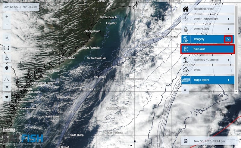
A quick way to check is to use our True Color satellite imagery layer. Are all the recent satellite photos covered in clouds? That means we won't be able to get any usable temperature or chlorophyll data from those satellite passes that day.
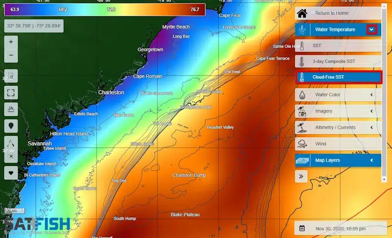
Sometimes it will be socked-in cloudy for a day or more, which means we won't be able to get any high-def shots that day. But not to fear - those days are perfect to use our Cloud-Free SST, 3-day Composite SST, and 1-day or 3-day Composite Chlorophyll charts! That way, you can still get a general idea of where the temps are ideal for your target species and where to start looking for temp and color breaks that gather life and gamefish.
And when the skies do clear up, our processing software will still be running full-speed to bring you the latest high-def shots as soon as the data are available.